LENGTH
4.8 mi
ELEVATION GAIN
525 ft
DIFFICULTY
Moderate
TAGS:
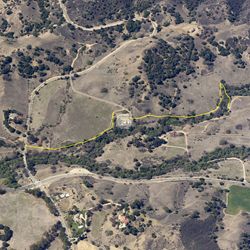
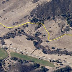
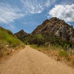
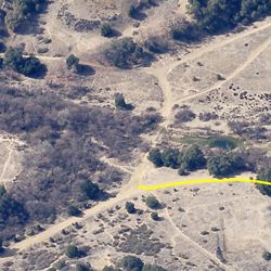
The Las Virgenes Trail rises up above and roughly parallels Las Virgenes Road in Calabasas. The trail’s gentle terrain, elevation changes, and open vistas make it ideal for casual trail users, mountain biking and equestrian use. Visitors will experience a varying landscape of coastal sage scrub, grassland, chaparral, and oak woodland. Scenic vistas at 1,100 feet toward the mountains to the south will reward your gentle climb.
From the 101in Calabasas, head south on Las Virgenes Rd. Limited parking is available at the northeast corner of Las Virgenes Rd and Mulholland Highway or, better and safer, at King Gillette Ranch or Malibu Creek State Park.
TRAIL INFORMATION
ALLOWED USES:
- Hiking
- Mountain Biking
- Horseback Riding
- Dogs on Leash
LINKS:

 TRAIL MAP
 ELEVATION PROFILE

 NEARBY TRAILS

 FLORA & FAUNA


 ADD A REVIEW
Kachemakra: Re: Las Virgenes View Trail
3 years ago
Fred EFoster
4 years ago
