Eaton Fire Closures & Palisades Fire Closures
Fri, Jan 09 12:00 AM - Fri, Dec 31 12:00 AM
- Eaton Fire Closure -
CLICK HERE for Interactive Map of Eaton Fire Trail Closures
LA County Trail Closures
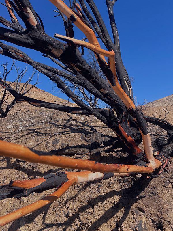
Trails in Eaton Canyon and surrounding areas damaged by the January 2025 Eaton Fire remain closed until December 31, 2027. This is to protect the public and allow for the recovery of burned wild lands.
The following Trails remain closed:
- Altadena Crest Trail
- Altadena Crest Trail Connector
- Chaney Trail (adjacent Chaney Trail Road is currently closed to vehicular traffic until Fall 2026)
- Eaton Canyon Trail
- Hasting Debris Basin Trail
The following Recreational sites remain closed:
- Eaton Canyon Waterfall
For more information about why Eaton canyon is closed please visit: https://trails.lacounty.gov/NewsAndEvents/1257/eaton-fire-trail-closures
US Forest Service Trail Closures
In effort to protect the public and to facilitate natural recovery of the resources affected by the Eaton Fire, the Eaton Fire Area Closure is extending through December 31, 2027.
The following Trails are now reopened:
- Sunset Ridge Trail - Chaney Trail Road which leads into Sunset Ridge Trail is currently closed to vehicular traffic until Fall 2026. The road is managed by LA County Public Works. If closed, plan to hike in or bike in.
- Dawn Mine Trail
- Tom Sloane Trail
- Bear Canyon Trail
*Please note that some LA County trails are adjacent to these trails and remain closed. These trails include: Altadena Crest Trail, Altadena Crest Trail Connector, Chaney Trail (unpaved) & Eaton Canyon Trail.
The following Roads remain closed:
- Chaney Trail Road (paved) - Closed to vehicular traffic until Fall 2026
- Mount Wilson Toll Road (below Mt Wilson Trail)
- Mount Wilson Toll Road (below Henniger Flats)
- Mount Wilson Road Henniger Flats
The following Trails remain closed:
- Idlehour Trail
- Castle Canyon Trail
- Sam Merrill Trail (Lower)
- Sam Merrill Trail (Middle)
- Sam Merrill Trail (Upper)
- Echo Mountain Trail
- Mount Lowe Trail (West)
- Mount Lowe Trail (East)
The following Recreational sites remain closed:
- Henninger Flats (operated by LA County Fire and Forestry Division)
- Idlehour Trail Camp
- Inspiration Point
- Echo Mountain Picnic Site
- Mount Lowe Picnic
- Sierra Saddle Picnic
- Millard Canyon Campground - Trails in Millard Canyon are open, however the campground remains closed. Passing through the campground area is allowed, but camping is prohibited. Restrooms, potable water, bear boxes, and fire rings are unavailable. Chaney Trail Road which leads into Millard Canyon is currently closed until Spring 2026. The road is managed by LA County Public Works. If closed, plan to hike in or bike in.
For more information about the US Forest Service closure please visit: Eaton Fire Area Closure Alert
City of Sierra Madre Trail Closures
The following Trails remain closed:
- Bailey Canyon Wilderness Park - Trails in Bailey Canyon remain closed.
The following Trails are now reopened:
- Palisades Fire Closure -
MRCA Closures
Temescal Gateway Park is Open: https://mrca.ca.gov/press/temescal-gateway-park-is-open/
PACIFIC PALISADES, CA (July 13, 2026) — Eighteen months after the devastating Palisades Fire, the Santa Monica Mountains Conservancy (Conservancy) and the Mountains Recreation and Conservation Authority (MRCA) announced today that Temescal Gateway Park has reopened to the public, marking a major milestone in the recovery of one of Pacific Palisades’ most treasured public landscapes.
The reopening follows 18 months of fire suppression, storm recovery, emergency operations, regional logistics, and park restoration that have transformed Temescal Gateway Park from the front lines of one of Southern California’s most destructive wildfires back into a place for outdoor recreation and renewal.
Visitors can hike the rebuilt Rivas Trail to two scenic overlooks or continue to Will Rogers State Historic Park. The Sunset Trail is open, providing access to Temescal Ridge Trail and Topanga State Park. Park users can also enjoy the Sycamore Grove and Rubell Picnic Areas.
The popular Temescal Canyon Trail to the waterfall will remain closed until further notice because fire damage created unsafe trail conditions.
Read Full Amended Order: https://mrca.ca.gov/order-of-closure-for-smmc-and-mrca-as-amended-may-23-2025/
[Amended June 16, 2025]
ORDER OF CLOSURE
LIFTED FOR ALL MRCA AND SMMC PARKS, TRAILS, AND PUBLIC ACCESSWAYS
EXCEPT FOR THE FOLLOWING PROPERTIES THAT REMAIN CLOSED:
- GREENBRIAR TRAILHEAD
- VANALDEN TRAILHEAD
Closed In the City of Malibu:
- LECHUZA BEACH AT BUNNIE LANE ENTRANCE; 31736 & 31712 BROAD BEACH ROAD
- VIA LINDA ACCESSWAY AT CARBON BEACH
- CARBON LA COSTA BEACH
- MARITIME ROCKS BEACH
- DOLPHIN VIEW COASTAL OVERLOOK
- MIRAMAR COASTAL OVERLOOK
Findings:
A. Governor Newsom issued a Proclamation of State of Emergency on January 7, 2025 regarding the Palisades Fire, which proclamation remains in effect. All areas accessible from Pacific Coast Highway (PCH) from Sweetwater Mesa Road east to McClure Tunnel, and from McClure tunnel westbound to Sweetwater Mesa Road are closed to regular traffic. All parks, trail easements, and public accessways are closed that normally would be accessible from PCH are therefore closed to regular public use.
B. Other areas within and immediately adjacent to the city of Malibu and within the Topanga watershed south of Mulholland Highway are subject to potential wildfire conditions such as were responsible for the Palisades Fire, these include popular hiking trails that lead into areas where heavy public use during the state of emergency, including fire sightseeing, pose a threat of renewed of fire activity and other public safety dangers that require a restriction of recreational activity during this emergency period.
California State Park Closures
Significant Incidents Dashboard
Topanga State Park and Will Rogers State Historic Park recovery planning website
- TOPANGA STATE PARK
Current Status: Open with Restrictions in services and/or facilities https://www.parks.ca.gov/post/51 - District Superintendent Order No. 915-25-012 - Topanga State Park Partial Closure
Details: Due to the impacts of the Palisades Fire, some areas of Topanga State Park remain closed to the public. - Effective 6/12/2026; day use facilities, backcountry service roads, and backcountry trails in Topanga State Park are open to all visitors with the following exceptions that remain closed:
- Rogers Road Trail
- Bent Arrow Trail
- Josepho Spur Trail
- Rustic Canyon Trail
- Lower Topanga Day Use Area and Trails
- Temescal Canyon Trail
- Please Note: Topanga State Park shares boundaries with City and County of L.A., NPS, and MRCA. Please consult their public information offices regarding their closure areas. ************
- Direct questions or concerns to: angelesinfo@parks.ca.gov.
- WILL ROGERS STATE HISTORIC PARK
Current Status: Open with Restrictions in services and/or facilities
Reason: Wildfire: Palisades Fire
Details: Posted 1/29/26:- West Inspiration Loop trail and road will be temporarily closed beginning 1/29/26 for ongoing work.
- Lower Betty Rogers Trail (front of the park) will be fully closed at the road and at the footbridge by the steps to keep hikers off the active roadway.
- The loop road will be closed just west of the Inspiration Point access road, but Bone Canyon Road and Inspiration Point will remain accessible.
- Thank you for your patience while we make improvements, we will keep you updated as work progresses.
- We kindly ask that all visitors remain on designated open areas and trails. Please remember that all parks close at sunset
- FAQs: Reopening of Will Rogers State Historic Park
- Press Release (11/10/25): California State Parks and Palisades Community Celebrate Reopening of Will Rogers State Historic Park.
- WILL ROGERS STATE BEACH : https://beaches.lacounty.gov/will-rogers-beach/, https://www.parks.ca.gov/?page_id=625
Current Status: Open with Restrictions in services and/or facilities
Details: Due to wildfire recovery efforts, Will Rogers Parking Lot 5 is closed to the public. 17580 Pacific Coast Highway. Updated: 1/9/2026
NPS Closures
Santa Monica Mountains National Recreation Area Map