Eaton Fire Trail Closures
Trails in Eaton Canyon and surrounding areas, including trails in Altadena, damaged by the January 2025 Eaton Fire remain closed at least through December 31, 2027, with the likelihood of an extended closure. This is to protect the public and allow for the recovery of burned wild lands.

Safety First: Why the Canyon Is Still Hazardous
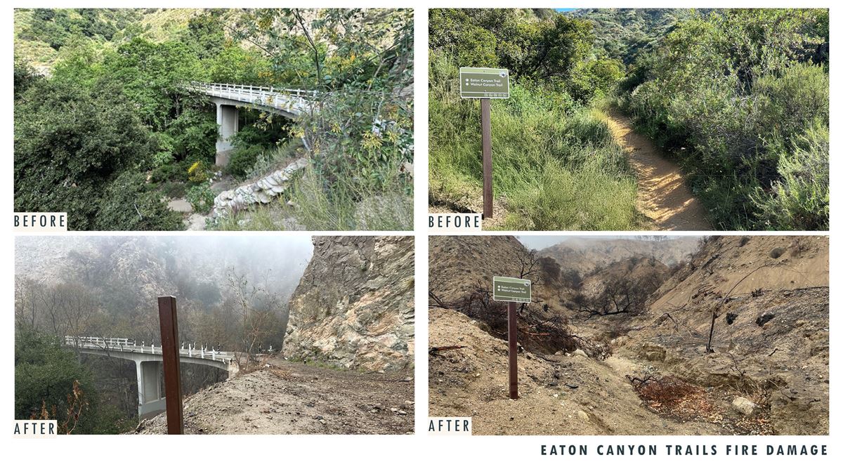
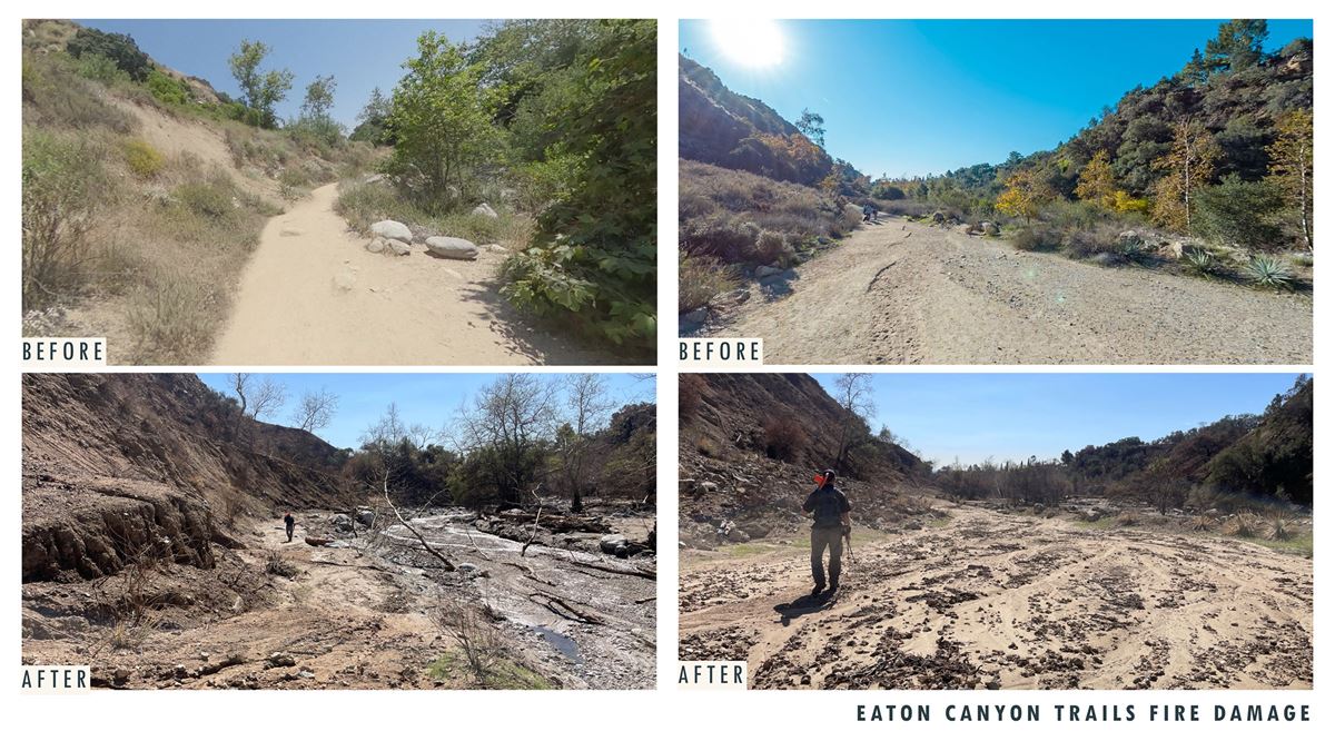
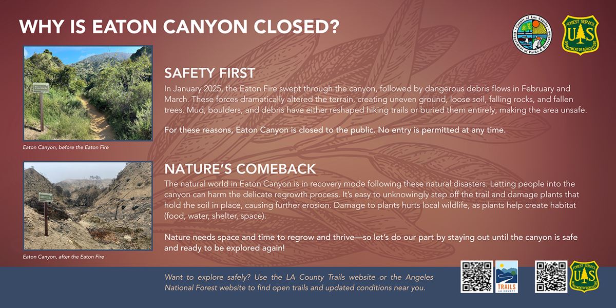
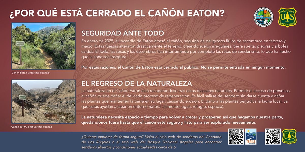
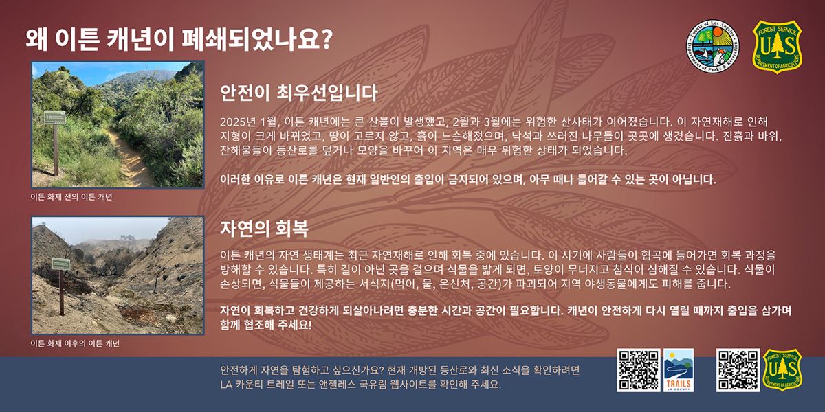
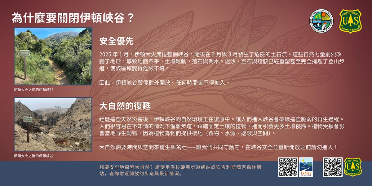
In January 2025, the Eaton Fire swept through the canyon, burning at high intensity across steep slopes and densely vegetated areas. The wildfire stripped away stabilizing vegetation, leaving the soil exposed and hydrophobic —soils that repel water rather than absorb it.
Just weeks later, a series of atmospheric river storms slammed into the burn scar, triggering powerful debris flows, flash flooding, and landslides. These back-to-back disasters dramatically altered the terrain. What were once well-used trails and scenic overlooks are now areas of active hazard—highly unstable, unpredictable, and dangerous to enter.
Visitors today may encounter a range of serious safety risks, including:
- Collapsed or eroded trails: Many trails were destroyed or dramatically altered by fire and flood. Some are visibly washed out or buried, while others appear intact but are structurally unstable—undermined by water and prone to sudden collapse under weight. Navigation is unreliable, and familiar routes may lead into dangerous terrain.
- Unstable slopes and loose soils: Burned slopes no longer have the root structures needed to hold soil in place. Even slight pressure or rainfall can trigger slope failure, landslides, or rock sloughing. This is especially dangerous on narrow trails and ridgelines, where there’s no room for error.
- Falling rocks and dead trees: Fire-killed trees are still standing but are structurally weakened and prone to dropping limbs or toppling entirely without warning. Similarly, canyon walls destabilized by fire and flood are actively shedding rocks and boulders, especially during windy conditions or after rain.
- Damaged bridges and infrastructure: Key bridges and trail railings were partially destroyed or buried in sediment. Some structures appear usable but have internal damage or undermined foundations, making them unsafe to cross. Informal use could accelerate deterioration or result in collapse.
- Hidden debris and chemical hazards: Floodwaters carried sharp metal, broken glass, melted plastic, and potentially toxic residues from destroyed structures and burned household materials. These hazards are often buried beneath just a few inches of mud, leaf litter, or regrowing plants—making them hard to spot until stepped on.
- Exposure risk from future flooding: Even a small storm can now cause dangerous runoff and flash flooding in the canyon due to the loss of vegetation and altered drainage channels. Narrow corridors like the Waterfall Trail act as natural funnels for intense flows of water, mud, and debris, with little time to react or escape.
Even experienced hikers and first responders face significant challenges navigating this post-fire terrain. Until these hazards can be fully assessed and mitigated, public access remains too risky—for visitors and for those who would need to assist them in an emergency.
Nature’s Comeback: A Delicate and Ongoing Process
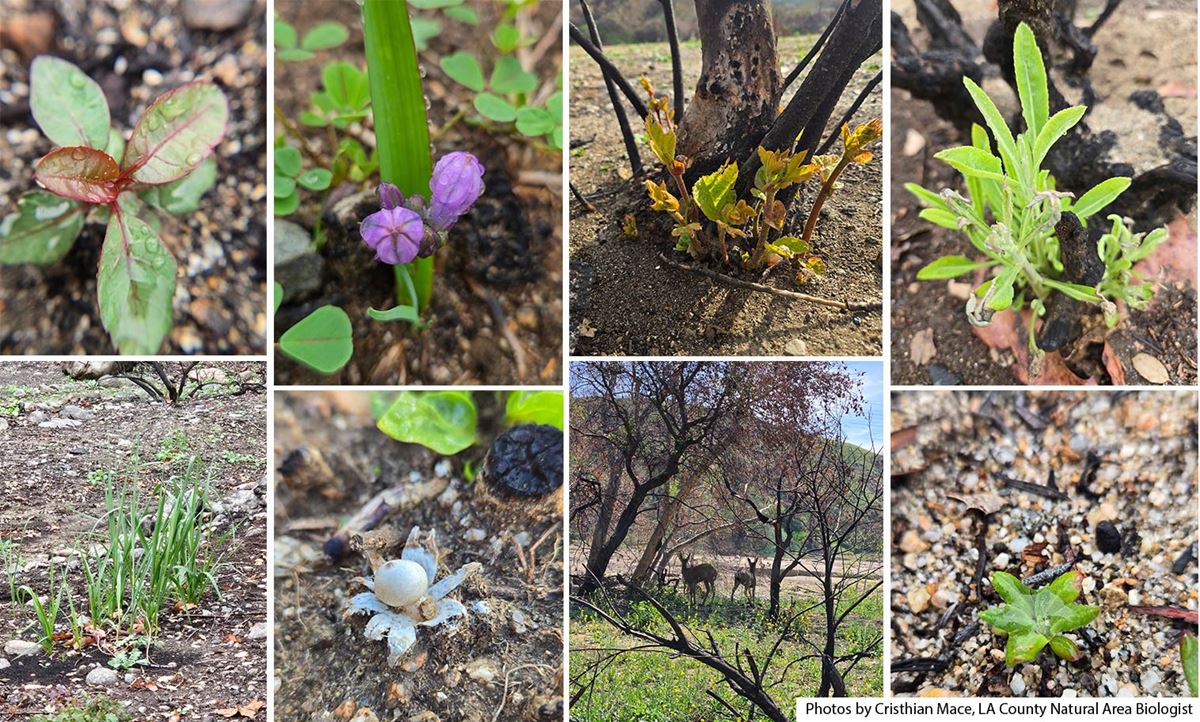
Eaton Canyon is showing signs of life again, but this recovery remains fragile. While many native plants have moved beyond the seedling stage, others are only now emerging—especially in shaded or cooler microhabitats where fire intensity and soil conditions varied.
Staggered Growth Across the Landscape. Native species like bush poppy, deerweed, chia, and golden yarrow are blooming in patches where soil conditions and moisture supported earlier germination. In other areas, particularly on steep or shaded slopes, germination is just beginning. This staggered recovery is normal for Southern California ecosystems and reflects the incredible diversity of microclimates and seedbank conditions in the canyon. While the vegetation may appear “greener,” much of the growth is still vulnerable to trampling, erosion, or soil compaction—especially along informal trails or fire-scarred slopes.
Wildlife is Returning—Cautiously. Insects, birds, and small mammals are gradually returning to forage and nest among the recovering vegetation. Chaparral birds like wrentits and California towhees have been observed reestablishing territories, while deer tracks mark renewed movement through the canyon. Many of these species rely on low shrubs and early successional plants for cover. Disturbance now, especially off-trail, can disrupt foraging, nesting, and recolonization patterns.
Invasive Species Are Gaining Ground. Non-native species such as shortpod mustard, red brome, and wild oats are spreading aggressively in some areas. These fast-growing annuals can form dense mats, crowding out native forbs and grasses and significantly increasing future fire risk. Managing invasive species is an uphill battle even in ideal conditions—public pressure on the landscape makes it harder. Shoes, dogs, and equipment can unintentionally carry and spread seeds, especially along disturbed edges.
This Is a Critical Window. Revegetation is happening—but it’s not stable yet. The next several months will determine whether native species gain a foothold or if invasive plants dominate and degrade the habitat. By staying off trails and respecting the closure, the public helps ensure that Eaton Canyon can continue its comeback as a biodiverse, fire-adapted landscape.
FAQ's
Where else can I hike nearby?
Many other scenic and safe trails remain open. Conditions may change, so always check agency updates before heading out. Nearby options may include:
- Santa Anita Canyon and Chantry Flat
- Gabrielino Trail
- Switzer Falls Trail
- Deukmejian Wilderness Park
- Hahamongna Watershed Park
The FAQs are part of an interagency effort to keep the public informed and engaged while Eaton Canyon Natural Area recovers from the devastating effects of the January 2025 fire and subsequent mudflows.
Resources
Want to learn more about why areas remain closed, visit the Eaton Canyon Post-Fire Burned Areas Emergency Rehabilitation Report at: https://inciweb.wildfire.gov/incident-information/caanf-eatonhurst-postfire-baer.
Want to explore safely? Visit Angeles National Forest website & Download the Trail LA County app on the App Store or get it on Google Play.
