0.3 mi
36 ft
Moderate
*** Please note: This trail is designated for pedestrian use only. Equestrian activity and bicycle use are prohibited. ***
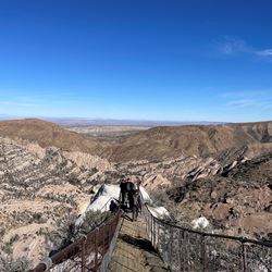
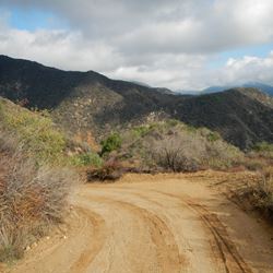
The Piñon Pathway Trail is a short (.17 mile) mostly level trail that remains on the rim of Punchbowl Canyon. It faces north toward massive sandstone slabs. These slabs are tilted by compressed movement along the Piñon Fault. You can see this fault in the distance along the base of reddish-orange Piñon Ridge. The San Andreas Fault is just to the north over Piñon Ridge. The Pacific Tectonic Plate collides with the North American Plate at the San Andreas Fault and the compression causes the up-lift of the San Gabriel Mountains and Piñon Ridge, thus tilting the Punchbowl sandstone up on end.
From this vantage you are overlooking the Mojave Desert with the Tehachapi and Sierra Nevada Mountains in the distance. On most days you can look 150 miles across the Mojave Desert and see Mt. Whitney (14,505 ft. elevation) in the High Sierra and Telescope Peak (11,079 ft. elevation) in the Panamint Mountains over Death Valley. On a ridge to the east you can look all the way across California and see Mt. Charleston (11,916 ft. elevation) close to Los Vegas in Nevada.
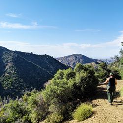
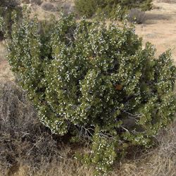
Many of the Pinyon Pines which lined this trail (thus the name) have died in the past 10 years due to extreme drought. There are young seedlings in the area, but it will take hundreds of years to grow large trees. Given time (and no fires) the forest will grow back.
ALLOWED USES:
- Hiking