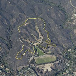
LENGTH
4.3 mi
ELEVATION GAIN
480 ft
DIFFICULTY
Difficult
TAGS:
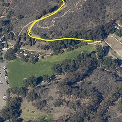
This trail lies between Temescal Gateway Park to the west and Will Rogers State Historic Park to the east, and therefore can be assessed from both parks. The trail winds around the base of the canyon and passes through a streambed. The dense vegetation provides hikers with good shade.
The trail can be accessed from the main entrance at Will Rogers State Historic Park. From PCH, head east on Temescal Canyon Rd.Take the second right onto Sunset Blvd. Turn left onto Will Rogers State Park Rd. Staging areas will be on the left.
TRAIL INFORMATION
ALLOWED USES:
- Hiking
LINKS:

 TRAIL MAP
 ELEVATION PROFILE

 NEARBY TRAILS


 FLORA & FAUNA


 ADD A REVIEW
Lucy
a year ago
