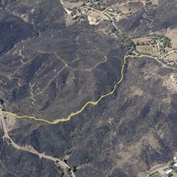
LENGTH
1.2 mi
ELEVATION GAIN
256 ft
DIFFICULTY
Moderate
TAGS:
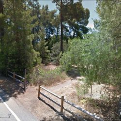
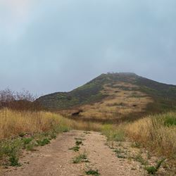
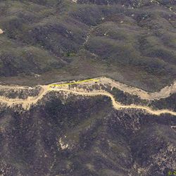
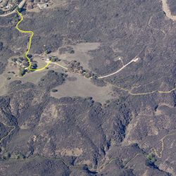
The trail follows a dirt road that connects Encinal Canyon Road to Mulholland Highway. The section of trail closest to Encinal Canyon Rd. runs through open areas surrounded by low vegetation. The trail then becomes more forested as it gets closer to Mulholland Highway. The road is gated off to vehicular traffic. This route makes a great loop trail with the Backbone Trail - Encinal to Mulholland Trail.
From the PCH, take Encinal Canyon Rd. approx. 5 miles. Make a right-hand turn to continue on Encinal Canyon Rd. Travel approx 1.2 miles to the trailhead. From 101 take Kanan Dume Road, turn west onto Mulholland Hwy. Stay left at the fork onto Encinal Canyon Rd. Travel 2.4 miles to staging area.
TRAIL INFORMATION
ALLOWED USES:
- Hiking
- Mountain Biking
- Horseback Riding
- Dogs on Leash